The Sonora Desert is - R-U-G-G-E-D

What's coming around the bend??
Phoenix and its attached municipalities (Mesa, Scottsdale, Tempe, Glendale, Sun City, etc. etc.) form a megalopolis known locally as the Valley of the Sun, occupying a space roughly 40 miles square and, home to over 4,000,000 residents. It’s an area where grass seed and sod companies must be on permanent strike! There’s NO GRASS! ANYWHERE! (Golf courses excepted…but…not always). Must be a great place to be in the “pea gravel” business. No lawn mowing but lots of gravel raking. Interestingly, 50% of the land within the cities is undeveloped making for a huge sprawl and, lots of room to grow. There are more damn “old farts” here than in Florida!! Gotta get outta town fast for fear that we might fit in!!!
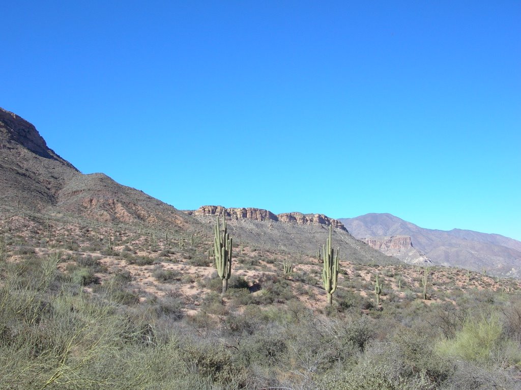
One tiny little FACT that the guy who said “you MUST drive Arizona Highway 88 to the Roosevelt Dam” forgot to mention was that many people drive this route in caravans of rented jeep CJs. There is a VERY good reason!!! This “highway” is 42 miles long and is paved for 6 or 7 miles at MOST. The rest is dirt (not gravel). About 30 miles is a single lane!! Oncoming trucks are a bit of a problem. Who blinks first? Backing up around a switchback is REALLY fun! Oh yeah…it also climbs and drops 1000’s of feet through the mountains of the Sonora Desert and there have to be 100’s of switchbacks. I drove it in about 4 ½ hours. Take out lunch at the one (1) restaurant/bar on the route, a few picture stops and a few “fear stops”. 42 miles and say 3 ½ hours of driving. You do the math!! The whole road is washboard, potholes and shear drop-offs. BUT……….the scenery is breathtaking (I know, I know, I use that word FAR too much). The problem was that there was nowhere to stop in order to take pictures. A local tour guide says -
“40 miles of steep, winding and mostly unpaved road past magnificent scenery of twisted igneous mountains with dense forests of saguaro and ferocactus, and several deep blue lakes. Past the lakes, the trail continues in more traditional fashion to the former copper mining town of Globe, but it is the western half which is the most scenic and well-known; however caution is required when driving and it is not recommended for large RVs or caravans; the largest RV rental company in the US does not allow their vehicles do be taken on this route.”
This road is also known as the Apache Trail since it follows a migration route used by Apaches between their winter and summer homes. It is probably the worst highway I have ever been on and, as soon as Brenda returns, we’re heading right back there. She’s GOT to see it. If you are ever in this area don’t miss it! Maybe rent a jeep. Our Honda 4WD – the “Puny Peacan” kept right up with them ol’ jeeps. The couple in the formerly shiny yellow Ford Mustang (top down) looked like refugees from a “Dust Bowl reunion”. The price of being cool!!!
No comments:
Post a Comment