Tuesday, January 30, 2007

Mesas and Monuments


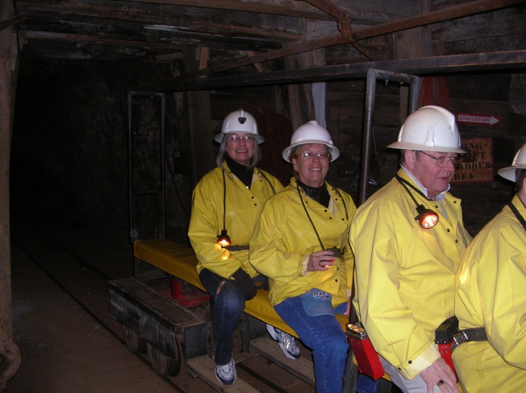
About 200 people would have lived in this village. Friends just "dropped in"


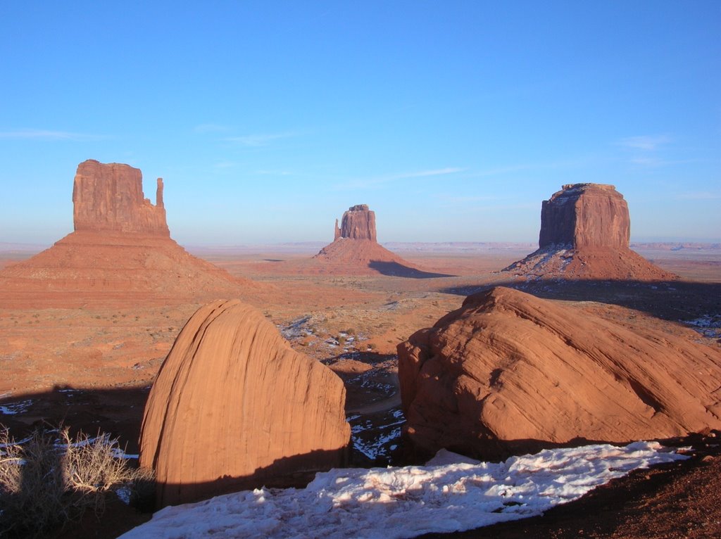
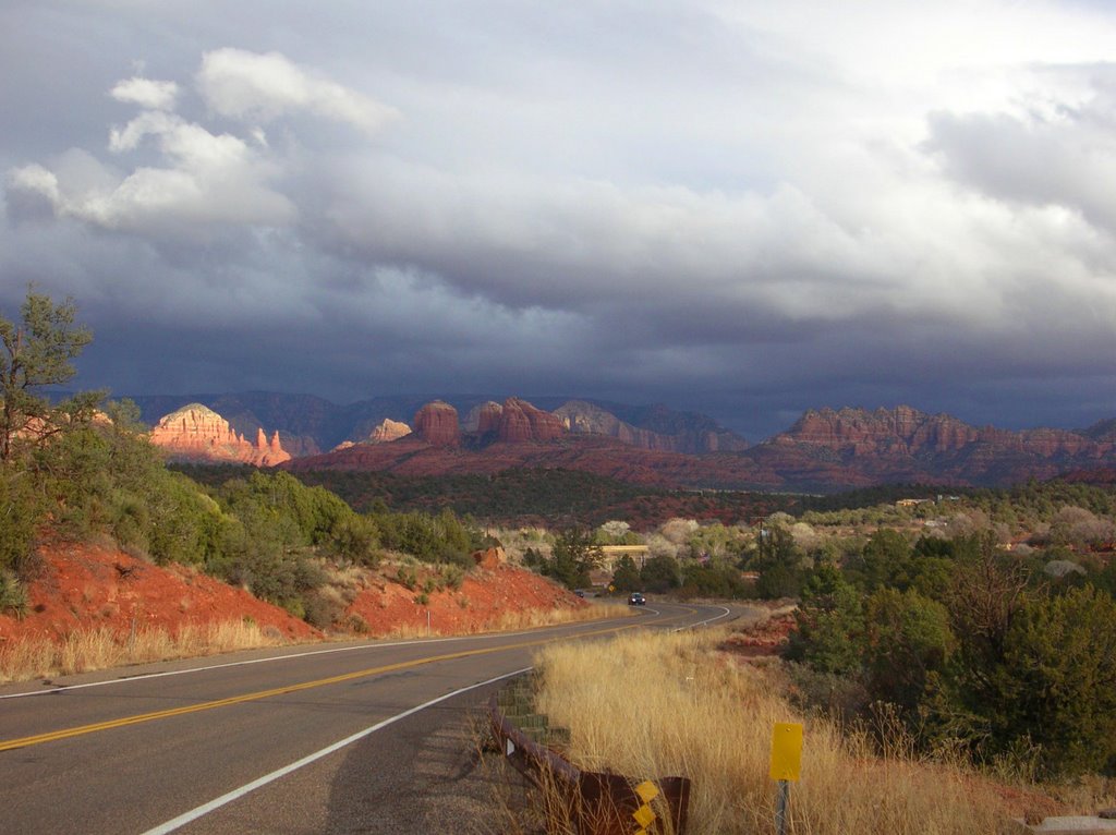
These monument rocks are the size of small mountains


Mesa Verde is a short distance south of Durango and well worth a visit. The top of the mesa is from 7,000 to 8,000 feet high and, at one time, supported a population of as many as 40,000 Anisazi, ancestors of the current Pueblo Indian tribes (more people than live in the entire region today). The mesa has been inhabited since 400 A.D. Early settlers lived in pit-houses dug into the mesa’s top surface, graduating to adobe pueblos, also on the surface. As time went on the inhabitants moved onto the numerous canyon walls and built fabulous cliff-dwelling “settlements” inside the many cave-like openings, suspended midway down the walls. Sleepwalking could have been fatal!!! These people eventually vacated the mesa and the area, due to years of drought and, moved south. By reason of the overhanging canyon walls, the settlements are extremely well preserved. They are largely protected from the elements,. The primitive technologies used in building and, other life skills are impressive. The National Parks Service wins again!!

It was a race to get to Monument Valley before sunset. With a quick stop at “The Four Corners”, I got someone to take a picture with parts of my feet in each of Colorado, Utah, Nevada and New Mexico. The drive passed places such as Wildcat Canyon and Rattlesnake Gulch (I now know what a gulch is…..) After almost running out of gas…….(gas stations are not so numerous in the open spaces), I made it to Monument Valley in time to catch a so-so sunset. But, the monument rock formations are anything but so-so!! It is easy to see why the Indians considered the area sacred. John Wayne is BIG in these parts ma’am. He made a lot of movies here!!

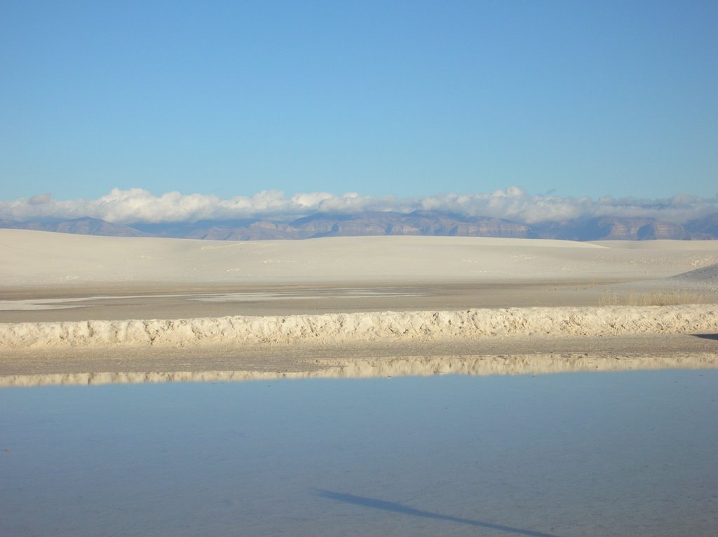
The big open spaces of southern Colorado and Utah and northern Arizona are very empty. I was without cell phone coverage for a couple of days and, learned to keep my gas tank at least half full. In severe weather, I would be traveling with a week’s worth of groceries………just in case. Funny how we get used to all the conveniences near-at-hand.

Sunday, January 28, 2007

Ski and Sky


The "Killer B's"


Our leader attacks the hill


Durango has mountains - We have a river


A week of skiing in Vail has come to an end with everybody going home having all of their parts more or less in tact. Our fearless leader, Mike O, has been organizing these annual jaunts for more than 20 years and, he does a great job!! It is always a week of great skiing, lots of laughs and, once in a while, a libation or two (one tequila, two tequila, three tequila, floor!!) In the past few years the group has divided into the “A” team and the “B” team. The “A” team is focused on jumping off cornices, racing through the trees and finding the “steep and deep” stuff. The “B” team, on the other hand, is more concerned with preserving life and limb and getting a good seat at the bar. I remain a proud member of the “B” team! Funny how the “A” team members want to ski with the B’s when they are injured, ill (hung over), or otherwise not up to the challenge. We B’s wear their abuse with pride!!

The run back to Mesa (Phoenix) Arizona started with a trip south on the “Million Dollar Highway”, so named for the continuous million dollar views along the route. The road runs through the very high San Juan Mountains, taking in three mountain passes of 10,640, 10,910, and 11,018 feet. (The highest PEAK at Vail is 11,570 feet) The road is paved but extremely narrow and, for most of its length is sign posted for 10, 15 or 20 miles per hour. Speeding would be insane. There are few guard rails and, it is up to 2,000 feet straight down off the edge of the road. I wondered how many snow plough operators they lose each year?? I was told by a local not to even think of driving this road if there was one snow flake on it. There wasn’t! Someone does a good job of snow removal but, I sure am glad I wasn't driving the motorhome here!!

The old Colorado mining towns have found rebirth as holiday destinations with 5,000 square foot mountain vacation homes popping up everywhere. Towns like Leadville, Silverton, Durango and, of course, Telluride have all maintained their 80’s ambience (that’s 1880’s) and, welcomed the “boomers” with their desire for comfort and modernity. It would be nice if someone at Brockville City Hall would pay attention. The influx of “new money” has certainly caused these “dead mining towns” to flourish!! A night in Durango revealed numerous good restaurants, bars, and even a live music scene. Maybe a bunch of moneyed retirees moving in isn’t all bad!!

Wednesday, January 17, 2007

Arts and Crafts


Verrrry interesting .... the buildings in Santa Fe


No electricity and no running water but still going strong


Watch that first step ..... it's 400 feet straight down


It is claimed that Santa Fe has more art, artists, and art galleries than any other city in North America save New York City. Not per capital; just the most. Having toured the city, we would have thought that New York would be in second place!! Santa Fe is one big art gallery inhabited by a bunch of very interesting, arty people. Throw in the fact that it is the state capital, that most of the older buildings are adobe and, that the entire place is surrounded by beautiful mountains and, you have a very livable city. The climate is great too! A few inches of snow really throws ‘em for a loop though!!

Albuquerque has much of the same adobe architecture as Santa Fe but, without the arts. More of a “working city”. Still surrounded by desert and mountains and still very unique.

We have learned a great deal about the Plains Indians and, spent most of today at Acoma, an Indian pueblo village on top of a 400 foot mesa. This village has been occupied since the early 1100’s and, figures in the Acoman (the tribe) culture since much earlier in recorded history. It is the oldest, continually inhabited settlement in North America. The Plains Pueblo Indians (they make it VERY clear that they are not First Nations, Aboriginals or any of the other PC labels – they are natives or Indians and, prefer to be referred to by tribe) have historically been agrarian, living in permanent “pueblos”, putting them at odds with the nomadic and warlike Plains Indians (Comanche and Apache). Hence living on top of a 400 foot rock!! The history of the Pueblo Indian tribes is fascinating. (There are 6 - 7 tribes remaining) Even today, they remain matriarchal and, have endured over a millennium of persecution from nomadic tribes, the Spanish, and the Catholic church. But now they are thriving, due in part to their proud history but also their artistic skills in making the very famous, fine Acoma pottery, made without benefit of a potter’s wheel. It is feather light, very fine and holds liquid without benefit of interior glazing. The patterns are extremely intricate. Oh yeah, I almost forgot………the casino on the reservation helps a bit too.

Monday, January 15, 2007

Rocks


With 2 glass end walls, you can see right through the chapel


We'll be going back to Sedona!!


Just after sun-up at the Grand Canyon


Hanging on the side of a mountain, the Chapel of the Cross in Sedona Arizona is without a doubt the most beautiful place of worship we have ever seen. The beauty of this church lies in its stark simplicity surrounded by the remarkable red rock formations of Sedona. A 5 story wall of glass behind the altar allows worshippers a panoramic view of the surrounding red rock mountains. The signature cruciform support behind the glass wall extends downward almost to the valley floor 200 feet beneath the chapel. The entire area around Sedona is populated with unique, mammoth, eroded, red rocks. Just as in Banff, cameras are snapping everywhere but, trying to capture a panorama on a tiny; two dimensional piece of paper is a mug’s game.

Which segues into trying to capture the Grand Canyon in pictures. Can’t be done!!! The canyon is 277 miles long, up to 18 miles across and averages 1 mile deep. Try and capture that!! It seems to go on forever. Some of the major Colorado River rapids, which are visible from the south rim, look terrifying from one mile up. It’s hard to imagine how they would look when they are about to hit you in the face, in a raft. One interesting fact about Grand Canyon Park is that the Rangers will not allow salt on the roads. There have been light snow showers over the past few days and, the roads have become totally iced as a result of traffic and a beating sun. The temperature is just cold enough to ensure that the ice stays firmly attached to the roadways. We are getting very good at spotting Alabama, Georgia and other southern license plates and, we give them a WIDE berth. They seem to have SOME difficulty on the ice!!!! Sometimes funny, sometimes destructive!! According to a ranger, there were 3 rollovers yesterday plus numerous other fender benders and, the park isn’t busy!!

We didn’t get slammed from behind by any of our southern friends, so made it back to Flagstaff, then eastward to Albuquerque. No cell phone coverage much of the way??? Passed through the Painted Desert and the Petrified Forest. Ho hum, more beautiful scenery!! Dozens of long, long freight trains. Saw 3 at one time on the high plains. Vast spaces!! I know I sound like a shill for the US tourism industry but this is one big, beautiful country.

Thursday, January 11, 2007

Brenda makes new friends!!


8 billion pounds of copper came out of the original "Queen Mine"


Brenda's Tombstone gang!!


In the late 19’th century southern Arizona was a major engine of US economic growth, due to the vast deposits of minerals beneath its surface. Gold, silver, copper, zinc and other minerals were being discovered and mined at a furious pace, resulting in instant “boom towns” such as Bisbee and Tombstone. Companies such as Phelps Dodge (recently on the acquisition trail [unsuccessfully] for both Inco and Falconbridge) got their underground mining starts here. With the new wealth came the lawlessness made famous by Hollywood. Although the Hollywood versions have been embellished, the legends of Wyatt and Virgil Erp, Doc Holiday, and other famous gunfighters are founded in fact. In modern day Tombstone, Allen Street, the historical main street, is lined with plaques outlining who killed whom along each side and, the original “Boot Hill” cemetery is still being maintained. Brenda got in with the “wrong crowd” in Tombstone.

We are taking a break from our RV trip, heading to Phoenix today to leave the motor-home with a dealer for maintenance and, heading off by car to Santa Fe, Albuquerque and more northern (think snow) parts of Arizona and New Mexico. I’ll end up skiing in Vail with some Brockville buddies and Brenda will be heading to Florida to visit her parents and, wind up on a cruise with the “ski widows”. We may have an opportunity to “blog” along the auto trip but, I know that blogging from the ski trip would be a frowned upon activity. My body is very likely incapable of both skiing and blogging on the same day anyway!!!! IF….. there is no blog for the next couple of weeks, I’ll pick it back up in Phoenix in a couple of weeks.

Wednesday, January 10, 2007

Finally out of the desert and into……….the desert!


Saguaro Cactus can grow to 50 feet tall


Brenda and a big Organ Pipe Cactus


A few of the observa tories on Kitt Peak


Leaving Las Cruces kept us in the Chihuahua Desert for another day (OK…Maybe we don’t go that far in a day!!) but, as we approached Tucson, the desert landscape changed dramatically. We crossed from the Chihuahua Desert into the Sonora Desert. The two could not be more different. The Yucca and other vegetation grew larger and more robust and, the giant Saguaro (Sahuara) and Organ Pipe Cacti were everywhere. Very unique. These two cactus species are only found in the Sonora Desert. Lots of picture taking.

Tucson is another clean, modern, low rise, desert city with lots going on. We visited what is being touted as the Cistine Chapel of North America (the Mission San Xavier del Bac). Don’t you just love the hyperbole in tourist brochures??? The Mission was beautiful, very ornate and, completely different from the missions around San Antonio, although they were all part of the same Camino Real (Royal Road) from Mexico City. The Tucson Desert Museum, which is located well out in the desert, was a highlight which we didn’t want to leave except for the fact that we had reservations at the Kitt Peak National Observatory for a night of telescopic star gazing. The museum could easily take an entire day to fully explore.

But….star gazing with the largest group of telescopes at a single observatory anywhere. Museum schmuseum!! We arrived at the base of the mountain at 4:00 P.M. and drove up to 6900 feet for an orientation with a group of 3 other people. We were even supplied box lunches. We caught a great sunset from the mountaintop and went inside for more background and information. BUT…..when we next went outside, it was dark or, what I mean to say is IT WAS DARK. We immediately stopped after the door closed because we had no sense of where we were or, what was around. There are strict light protocols on the mountain. Looking up, the sky was more intense than we had ever seen. The Milky Way was almost a solid band of white. The telescope operators seemed to know what newbies would want to see and, served up Saturn and its moons, the Andromeda Galaxy, star clusters and other interesting astronomical features. It was a great night made even more exciting by the ride down the mountain road WITHOUT HEADLIGHTS!! Light pollution!! Actually, the staff has a good system of getting people off the mountain by taping over daytime running lights and having all cars closely and slowly follow a staff car, driven by someone who knows the mountain road. Different!

Sunday, January 07, 2007

Snow, Pseudo-Snow and Billy the Kid


Snow? Yup!


Snow? Nope. Gypsum.


He really was a "kid"


Exploring southern New Mexico is to be always surrounded by mountains and enveloped in the cobalt-blue sky of which the residents are so justifiably proud. It’s big. It’s clean and, it’s desert. We awoke on Saturday to a bit of surprise as pictured above. For eastern readers, in case you forgot what snow looks like……have a look. But, by noon it was sunny and warm. The snow was gone. Just the way we like visits from old man winter.

Smack dab in the middle of the US Army’s 4,000 square mile White Sands Missile Range, lies the 275 square mile White Sands National Monument, named as frequent readers will guess for the ……………white sand. The area is entirely ringed by mountains allowing for no water runoff. As a result, all gypsum eroded from the mountain sides collects in the basin. This natural “dune park” is in a pristine, natural condition because the military fires off rockets every now and then making any encroaching development and home building decidedly risky. This is the largest deposit of pure (97%) gypsum sand in the world and, the dunes are “snow white”. They are actively growing and moving leeward at the approximate rate of 15 feet per year. Building a road through the dunes is impossible because the moving sand would swallow it up. Access is across packed gypsum, regularly maintained by our buddies at the US National Park Service. (A high-power auto vacuum cleaner is a good idea!) Astronauts on the space shuttle use the White Sands Park as a reference point on this side of the earth and the Great Wall of China on the other side. Easily viewed from space. Walking the dunes on a sunny day requires very good sun glasses. It is a beautiful area.

Las Cruces and environs have even more of the Spanish/Mexican influence than did Texas. There are many more adobe buildings, the cactuses (cacti) are getting bigger and bigger and, our burning tongues are chugging Margaritas at an alarming rate. Everywhere in the area are signs: “Billy the Kid lived here”, “Billy the Kid slept here”, Billy the Kid was tried and convicted here”, and the final “Billy the Kid was supposed to be hung here”. But………….he escaped!!! No more “Billy the Kid” signs!!

There is an underlying awareness of the power of nature in this area and, it is respected.

Friday, January 05, 2007

Big Bend


A Big Bend vista - lots more where that came from


The Rio Grande's silt is so abrasive, it created the 1,500 foot deep canyon in the back ground


We succumbed to the frequent suggestions from our fellow RV travelers to visit Big Bend National Park, located where the Rio Grande River makes a…………..get ready for it………..big bend in the border between Texas and Mexico. The park is 130 miles south of Fort Stockton, which itself is about 300 miles from anywhere. We changed our plans to stay an extra day in Fort Stockton and, got an early start by car. The trip started across course grasslands, which quickly became the Chihuahua Desert, surrounded by the Glass, Santiago, and Woods Hollow Mountains. Once we entered the Park, which consists of over 800,000 acres, we were in the Chicos and Christmas Mountains. 180 miles of the big bend in the Rio Grande form the southern border of the park, resulting in a park consisting of mountain, desert and riverside terrain. Next time, we’ll make this a destination and stay longer. We did our damndest to get it all in but that would take a week.

Cameras cannot possibly capture the continuous panorama that assaults your senses every minute that you are in the Park. The vistas stretched “forever”, assisted by a cloudless, perfect day, under a beating sun. The summers get so hot here that some of the ranger stations close for the summer. January worked really well for us!! We saw grazing Texas Longhorns, wild boar (Javalina), jack rabbits and herds of mule deer (Brenda is getting very accomplished at picking the herds out of the scrub. Coupled with the marksmanship skills she exhibited to Jim, Michelle, and myself in San Antonio, she would make an excellent hunter………..we’d always have meat!!) We also saw many bird species including Roadrunners (the bird not the 1969 Chrysler product) and a few coyotes that were no so Wile E. (ie: dead at the side of the road). No bears or mountain lions but……no racing heartbeats either.

This park is for serious hikers who want to spend a week in the mountains, living out of what they can carry on their back. We did NOT join that club but, took some interesting “walks” to canyons and other features not accessible by road. We have learned that when RV’ers talk……….we listen. We would NEVER have found this place on our own.

Today (Friday) we continued across the Chihuahua Desert. This desert occupies a big chunk of northern Mexico, a large portion of west Texas and, extends as far north as Albuquerque, totaling over 140,000 sq. mi. It contains many mountain chains and lots of flat scrubland. El Paso and Las Cruces, New Mexico are both firmly anchored in the desert The “west Texas town of El Paso” of Marty Robins fame has become a west Texas city of over 500,000 inhabitants, who are spread over a vast area, divided down the middle by the Franklin Mountains. We’ll be exploring the area for the next couple of days.

Thursday, January 04, 2007

Happy New Year


San Antonio LOVES fireworks


This cavern cannot be captured by the camera!!


NOTE: Typed Wednesday, posted Thursday – no WiFi …….again!!!

The fireworks from the Tower of the Americas WERE spectacular. Well worth tackling the crowds! People were lighting competing fireworks in the street and the entire city was in serious “party mode”. The “friendly city” got even friendlier!! Afterwards, we got lucky and made it out of town in double quick time. But…….our biggest surprise was the drive home. The entire ½ hour drive (think downtown Toronto to Pickering) was through a thick haze of smoke. Everywhere we looked, near and far, fireworks were being launched till well past 1:30 A.M. The resulting veil of smoke blanketed the entire city and surrounding area. Freeway lighting created funnels of hazy yellow glow, creating a bizarrely eerie scene. Almost as unique as the fireworks at the tower.

We bid adieu to Jim & Michelle yesterday and, to San Antonio today. Great friends! Great city! Now on to Las Cruces, New Mexico. We are taking a few days to cross Texas, with a southern detour to the Big Bend National Park on the Rio Grande. No other sight has been so highly and repeatedly recommended by our fellow travelers at any point on our trip. So………I guess we gotta see it.

We are now at Fort Stockton Texas, mid way between San Antonio and El Paso. This is serious “western movie country”. Throughout the day we climbed continuously to our current altitude of 2,900 feet and, along the way the trees grew smaller and fewer in number until the landscape became buttes, bluffs, mesas and gullies, populated by scrub, cactus and yucca. Although the Texans say this area is a “whole lot of nothing”, it has a rugged beauty. Along the route, we detoured 7 miles to the “Caverns at Sonora”. I cannot describe them! The President of the National Speleological Society said “This is the most indescribably beautiful cavern in the world. Its beauty cannot be exaggerated, even by Texans”. Imagine a 1 ½ mile long cave, with 1 mile of it covered in pave diamonds! If you’re driving across Texas on I-10 (and who doesn’t do that a couple of times a year?) don’t even think of passing by these caverns. They are spellbinding!!!

Tomorrow………Big Bend


Postscript: We have just returned from Big bend national Park and, will publish a post in the next day or two. I am afraid that it will once more be filled with superlatives. Readers of this blog DO put up with a lot!!!